Hamburg Maps and Orientation
(Hamburg, Germany)
One of the most prosperous and wealthy cities in the whole of Europe, Hamburg lies to the far north of Germany. Best known for its enormous harbour, which has long been responsible for much of Hamburg's success and thriving economy, the region is always dominated by a series of lakes and waterways.
Home to a population of around 1.7 million, the city of Hamburg has grown to become the second-biggest city in the whole of the Federal Republic of Germany and has much to offer in the way of tourism. The main commercial hub of the city is without doubt the Merchant's district, where many enormous red-brick buildings dominate the area and house many notable German and international companies.
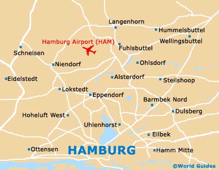
Maps and Orientation of the City
The three main rivers within Hamburg are the Alster, Bille and Elbe, all of which have shaped much of the overall landscape and layout. A neat gridwork of canals is also present around the city centre and gives Hamburg are very definite maritime atmosphere and feeling.
For city maps of Hamburg and beyond, the local tourist information centre (Hamburg Tourismus) will be more than happy to oblige, being located at the Hauptbahnhof train station, between piers four and five. They will also be able to provide a wealth of information about suggested day trips and excursions, should you wish to venture outside of Hamburg and visit one or more of the following surrounding destinations.
- Alsterdorf - 8 km / 5 miles (12 minutes, north)
- Bahrenfeld - 8 km / 5 miles (12 minutes, west)
- Barsbüttel - 14 km / 9 miles (20 minutes, east)
- Billbrook - 8 km / 5 miles (12 minutes, south-east)
- Langenhorn - 13 km / 8 miles (18 minutes, north)
- Moorfleet - 13 km / 8 miles (18 minutes, south-east)
- Norderstedt - 24 km / 15 miles (30 minutes, north)
- Ohlsdorf - 10 km / 6 miles (15 minutes, north)
- Oststeinbek - 19 km / 12 miles (20 minutes, east)
- Othmarschen - 10 km / 6 miles (15 minutes, west)
- Schnelsen - 14 km / 9 miles (18 minutes, north-west)
- Seevetal - 27 km / 17 miles (25 minutes, south)
- Tonndorf - 13 km / 8 miles (18 minutes, north-east)
- Wedel - 64 km / 40 miles (one hour and 10 minutes, west)
- Wilhelmsburg - 11 km / 7 miles (15 minutes, south)
Map of Germany

Map of Hamburg